
Chronology of the M 7.7 Major Earthquake that Struck NTT, Here is BMKG's Analysis
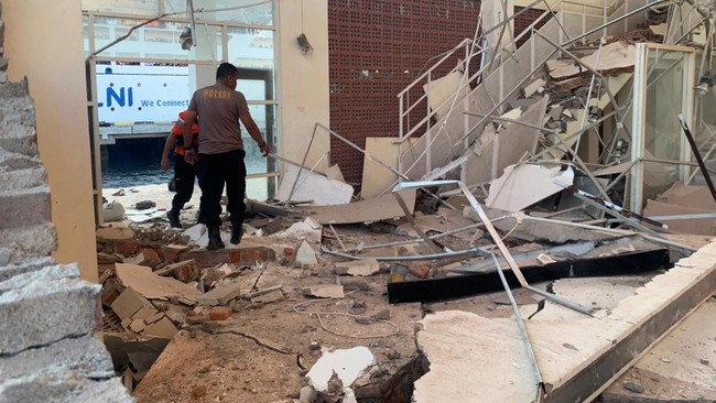
The Flores region of East Nusa Tenggara (NTT) was shaken by a powerful tectonic earthquake measuring Magnitude 7.7 on Saturday morning (15/8/2026) at 04.58 WIB. BMKG briefly issued a Tsunami Early Warning before officially ending it at 07.30 WIB.
BMKG analysis shows the shallow earthquake, at a depth of 15 kilometres, was centred at sea, precisely 30 km northeast of Nagekeo, NTT (8.41° S; 121.39° E).
“Taking into account the epicentre location and hypocentre depth, the earthquake that occurred was a shallow earthquake due to Flores Back-Arc Thrust activity with an upward thrust fault mechanism,” BMKG wrote in an official statement.
Following the earthquake, BMKG set SIAGA status (tsunami potential of 0.5-3 metres) for the areas of North Manggarai, North Ngada, Ende, East Flores, and Jeneponto. Meanwhile, WASPADA status (<0.5 metres) was applied to the Bima, Dompu, and Wajo areas.
Based on monitoring from sea level observation stations (tide gauges), a small tsunami was indeed detected hitting several coastal points, including:
Maurole (Ende): Height 0.94 metres (at 05.27 WIB)
Bulukumba: Height 0.54 metres (at 05.58 WIB)
Kewapante Port (Sikka): Height 0.38 metres (at 05.16 WIB)
Labuan Bajo: Height 0.36 metres (at 05.26 WIB)
Bau-Bau: Height 0.30 metres (at 05.47 WIB)
Other points such as Sikka, East Flores, Kolaka, Dompu, and Bakalang-Alor recorded wave heights between 0.14 and 0.25 metres.
BMKG moved quickly to issue periodic tsunami warning updates until the threat status was declared lifted:
Early Warning 1: Issued at 05.00 WIB (2 minutes after the earthquake).
Early Warning 2: Issued at 05.09 WIB.
Early Warning 3 (Observation Update): Released 4 times consecutively at 05.55 WIB, 06.28 WIB, 06.49 WIB, and 07.05 WIB.
Early Warning 4 (Termination): Issued at 07.30 WIB.
“Considering there was no further significant and dangerous rise in sea level, the TSUNAMI EARLY WARNING WAS DECLARED ENDED at 07.30 WIB,” BMKG explained.
The BMKG shakemap recorded the earthquake’s impact as being felt quite massively in various areas:
VII MMI (Light damage to buildings, residents leaving their homes): Aesesa (Nagekeo), Riung (Ngada), and Mbay Town.
VI MMI (Residents startled and running outside): Wolowae (Nagekeo) and Bajawa Town.
V MMI (Waking sleeping people): Ende Town, Borong Town, and Ruteng Town.
Up to 08.00 WIB, BMKG identified 52 aftershock activities with magnitudes ranging from M 3.6 to M 6.2.
BMKG urged the public to remain calm, avoid cracked or structurally damaged buildings, and not be easily influenced by irresponsible rumours.
Source: jawawa.id (https://jawawa.id/newsitem/chronology-of-the-m-7-7-major-earthquake-that-struck-ntt-here-is-bmkgs-analysis-1786765866)
Originally published by CNBC Indonesia (https://www.cnbcindonesia.com/news/20260815094608-4-759608/kronologi-gempa-besar-m-77-hantam-ntt-begini-analisis-bmkg), translated from Indonesian