
Chronology of Anak Krakatau Activity Leading to Eruption
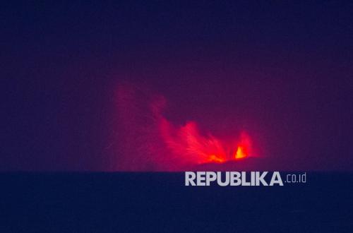
The Geological Agency of the Ministry of Energy and and Mineral Resources (ESDM) has outlined the chronology of Anak Krakatau’s activity leading up to its eruption in September 2026. The volcano’s activity has been increasing since July 2026, following a period of small-scale eruptions that lasted until December 2023.
Lana Saria, Head of the Geological Agency of the Ministry of ESDM, stated that the development of Anak Krakatau’s activity is inseparable from the major eruption on 22 December 2018. That eruption caused a partial collapse of the volcano’s flank, which subsequently triggered tsunami waves in the Sunda Strait.
“The eruption on 22 December 2018 resulted in landslides and tsunami waves,” Lana said during a press conference regarding the development of Anak Krakatau’s volcanic activity on Sunday (6/9/2026).
Following that event, a series of small-scale eruptions continued until 16 December 2023. Anak Krakatau then entered a new period of eruption starting from 2 July 2026.
On that date, the activity status of Anak Krakatau was raised from Level II (Alert) to Level III (Standby). The volcanic activity continued to escalate, entering an eruptive phase in September 2026.
At 23:00 WIB on 4 September 2026, Anak Krakatau experienced continuous eruptions. These eruptions were accompanied by lava fountains, rumbling sounds, and explosions.
“These lava fountains are one of the characteristics of the Krakatau volcano and are a common phenomenon in volcanoes with relatively low magma viscosity,” Lana explained.
Anak Krakatau’s activity reached its peak on 5 September 2026. The Geological Agency noted that the increased activity was marked by repeated and continuous eruptions.
Lana explained that these conditions indicate an ongoing supply of magma and gas within the volcano. However, frequent eruptions do not automatically mean that a larger-scale eruption will occur.
The Ministry of ESDM’s Geological Agency continues to evaluate Anak Krakatau’s activity based on all monitoring parameters. These parameters include seismic data, visual observations, deformation, gas emissions, satellite imagery, and field information.
The public and tourists are advised not to enter the area within a three-kilometre radius of Anak Krakataus’s centre of activity. The Geological Agency warned of potential hazards including pyroclastic flows, lava, volcanic ejecta, ash clouds, and heavy volcanic ash fall.
Source: jawawa.id (https://jawawa.id/newsitem/chronology-of-anak-krakatau-activity-leading-to-eruption-1788674117)
Originally published by Republika (https://news.republika.co.id/berita/tkxgm6393/begini-kronologi-aktivitas-anak-krakatau-hingga-erupsi), translated from Indonesian