
BPPTKG Reaffirms Mount Merapi Climbing Ban, Warns of Explosive Eruption Risk
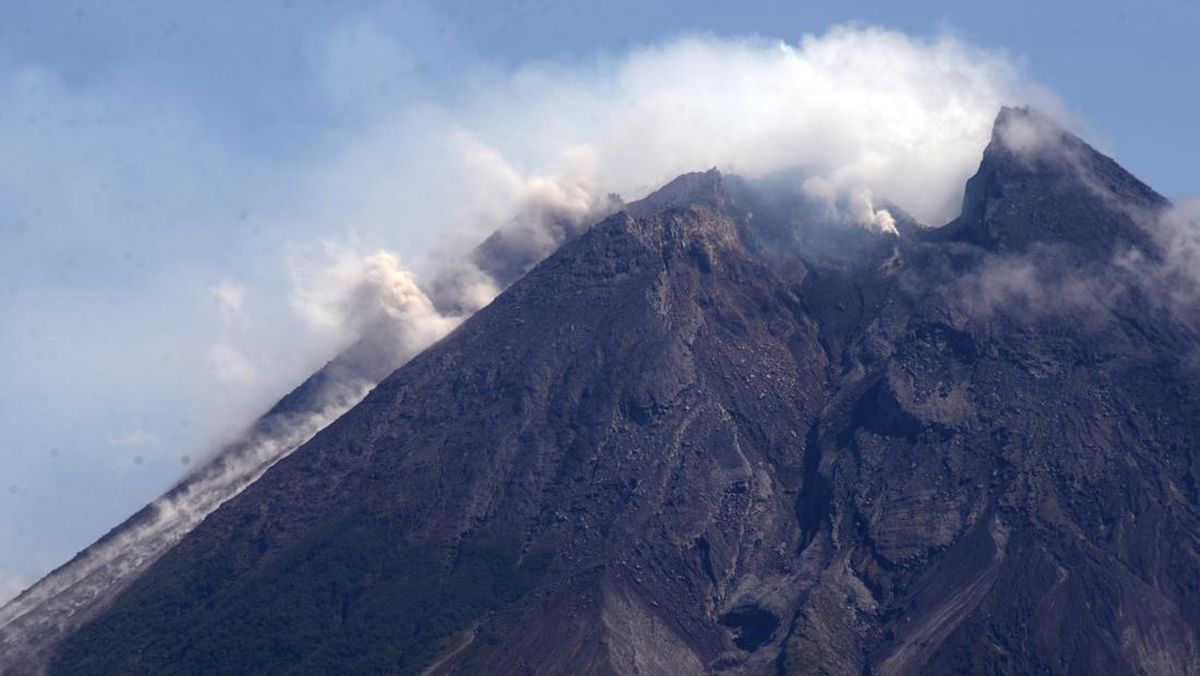
The Geological Disaster Technology Research and Development Agency (BPPTKG) has once again reminded the public to avoid climbing activities on Mount Merapi, as the potential for danger remains high.
BPPTKG Head, Agus Budi, emphasised that climber safety must be the priority, given that the threat of explosive eruptions could occur at any time. “We want to reaffirm that climbing activities on Mount Merability are currently highly discouraged for the sake of safety,” said Agus Budi on Wednesday (1/7).
Agus Budi explained that in the event of an explosive eruption, the projection of volcanic material could reach a radius of 3 kilometres from the summit. This range includes areas that have traditionally served as climbing routes or boundaries, meaning anyone within that zone is at high risk of being affected.
He also urged the public and climbers to understand the current dynamics of Merapi’s activity. According to him, Merapi is currently in an effusive eruption phase, characterised by the slow release of magma to the surface. However, this does not mean the threat has ended. In fact, during this phase, the potential for an explosive eruption remains high if the magma pathway becomes suddenly blocked.
“However, it is precisely in these conditions that the potential for an explosive eruption at any time remains high,” stressed Agus Budi.
He explained that a blockage in the magma pathway would cause an accumulation of intense gas pressure within the crater. This pressure could ultimately release energy in the form of a sudden, explosive eruption.
Three Centuries of Merapi Records
Furthermore, Agus Budi stated that this vigilance is based on historical data of Merapi’s volcanic activity. In the records of the last three centuries, Mount Merapi has demonstrated five different types of eruptions, with explosive types being the most frequent. Even so, Agus Budi noted that since the 2010 eruption, 32 explosive eruptions have been recorded, dominated by phreatic eruptions.
“Therefore, as long as this potential threat remains high, the closure of climbing activities in potential danger zones is the primary mitigation step that must be obeyed,” he concluded.
The Mount Merapi National Park Office (TNGM) previously also emphasised that climbing routes on Mount Merapi remain closed as of today. This statement was a response to viral social media content showing climbing activities and invitations to the public, even suggesting the reopening of Mount Merapi’s climbing routes.
TNGM Head, Heri Wibowo, explained that the closure of climbing routes has been in effect since 22 May 2018, following the increase in Mount Merapi’s activity status from Level I (Normal) to Level II (Alert). Subsequently, on 5 November 2020, the activity status was raised to Level III (Siaga/Danger), which remains in effect.
“Mount Merapi climbing activities are temporarily not recommended, except for the purposes of investigation and research related to disaster mitigation efforts,” Heri stated in an official statement on Monday (29/6).
Based on the report of Mount Merapi’s activity for the period of 19-25 June 2026 published by BPPTKG, volcanic activity remains classified as high with effusive eruption activity, and the volcano’s status remains at Level III (Siaga). Heri mentioned that the supply of magma to the surface is ongoing, which could trigger lava flows or pyroclastic flows (awan panas) following river paths on the mountain slopes at any time.
Currently, Heri stated, the potential danger of lava flows and pyroclastic flows is in the south-southwest sector, covering the Boyong River path with a maximum flow distance of 5 kilometres from the summit. Meanwhile, in the Bedog, Krasak, and Bebeng river paths, the potential for volcanic material projection can reach a maximum distance of 7 kilometres from the summit.
In the southeastern sector, the potential danger includes the Woro River path with a maximum flow distance of 3 kilometres and the Gendol River up to a maximum of 5 kilometres from the summit. Additionally, if an explosive eruption occurs, volcanic material in the form of incandescent rock projections is expected to reach a radius of up to 3 kilometres from the summit of Mount Merapi.
The TNGM Office also reminded the public not to engage in any activities within a 3-kilometre radius of the summit of Mount Merapi, in accordance with the recommendations of BPPTK/PVMBG.
According to the TNGM Office, the climbing route via New Selo towards the summit of Mount Merapi is actually within this high-risk area. The route includes the gateway to Post I, which is approximately 2.3 kilometres from the summit, Post II at 1.64 kilometres, Pasar Bubrah at 0.7 kilometres, and the summit itself. All these points are within the zone potentially affected by volcanic material projections or pyroclastic flows, making climbing activities extremely dangerous to the safety of climbers.
Source: jawawa.id (https://jawawa.id/newsitem/bpptkg-reaffirms-mount-merapi-climbing-ban-warns-of-explosive-eruption-risk-1782935425)
Originally published by CNN Indonesia (https://www.cnnindonesia.com/nasional/20260701145520-20-1375571/bpptkg-tegaskan-larangan-pendakian-merapi-waspada-erupsi-eksplosif), translated from Indonesian