
BNPB: Hotspots and Firespots Continue to Rise, Surrounding 6 Provinces with 74,000 Hectares of Land Burned
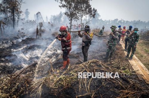
The National Disaster Management Agency (BNPB) recorded that hotspots and firespots from forest and land fires (karhutla) continued to increase until Wednesday (26/8/2026). Based on records for the period Wednesday (25/8/2026) from 00.00 to 23.59 Western Indonesia Time, there were 7,334 hotspots and 2,160 firespots spread across six priority provinces, with the area of burned land indicated to reach 74,868 hectares.
Acting Head of the BNPB Disaster Data, Information, and Communication Centre, Berton SP Panjaitan, said the six priority provinces in handling forest and land fires are West Kalimantan, Central Kalimantan, South Kalimantan, South Sumatra, Riau, and Jambi. In West Kalimantan, 2,610 hotspots and 64 firespots were reported, with an indicated burned area of 38,310 hectares. Visibility in the region was below 1 kilometre.
‘We need to convey that since yesterday several districts in West Kalimantan have experienced rain. This is due to the work of weather modification operations,’ he said during an online press conference on Wednesday afternoon.
In Central Kalimantan, there were 2,110 hotspots and 55 firespots. The indicated burned area reached 7,634 hectares with normal visibility above 10 kilometres. In South Kalimantan, 817 hotspots were reported, but firespots in the province reached 1,995. The indicated burned area was 9,605 hectares with visibility above 9 kilometres.
Berton added that in South Sumatra, the number of hotspots found reached 1,438 points, with 25 firespots. The indicated burned area was 1,926 hectares with visibility of around 3 kilometres. In Riau, there were 225 hotspots and 10 firespots, with an indicated burned area of 16,439 hectares and visibility above 1 kilometre.
‘We also need to convey that in Riau, rain has occurred in several districts since this morning. This is also because we have carried out OMC or weather modification operations,’ said Berton.
Finally, in Jambi, 134 hotspots and 11 firespots were found, with an indicated burned area of 954 hectares. In that province, visibility was reported at only around 1 kilometre.
According to Berton, efforts continue through ground operations to detect burned locations. After that, field officers carry out extinguishing and cooling. In addition, air operations are also conducted for patrols, water bombing, and weather modification operations. Currently, 52 air units have been deployed to handle forest and land fires.
‘Of the aircraft available, the fleet numbers 52, with 22 in Sumatra and 30 in Kalimantan, but two are currently being shifted to Lampung and one to East Java because there are fires there,’ said Berton.
He said a total of about 4.6 million litres of water have been used for extinguishing through air operations. ‘These 4.6 million litres were carried out with several sorties in 6 priority provinces, namely West Kalimantan, Central Kalimantan, South Kalimantan, South Sumatra, Jambi, and Riau,’ he said.