
BMKG Update: M6.5 Earthquake in North Sulawesi Triggered by Subduction, Causes Wall Vibrations
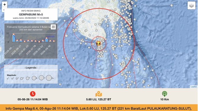
Jakarta, CNBC Indonesia – The Meteorology, Climatology and Geophysics Agency (BMKG) has updated information on the earthquake that just shook the region of North Sulawesi (Sulut).
In the latest update, based on BMKG’s analysis of the epicentre location and hypocentre depth, the earthquake was a shallow earthquake caused by subduction activity in the Cotabato Trench.
“The results of the source mechanism analysis show that the earthquake had an upward movement mechanism (thrust fault),” said the Director of Earthquakes and Tsunamis at BMKG, Wijayanto, in an official statement on Wednesday (5/8/2026).
“This earthquake has updated parameters with a magnitude of M6.5 at a depth of 10 km. The earthquake’s epicentre is located at coordinates 5.29°N; 125.43°E, or precisely at sea, 186 km north-west of Tahuna, Sangihe Islands, North Sulawesi. Tsunami modelling results show that this earthquake does NOT have tsunami potential,” added Wijayanto.
He explained that, based on the estimated shaking intensity map (shakemap), the earthquake was felt at intensity level IV MMI in the Marore Islands, Sangihe Islands; Miangas, Talaud Islands; and Kendahe, Sangihe Islands.
This means, Wijayanto explained, that the daytime earthquake was felt by many people inside houses, by several people outside, with pottery breaking, windows and doors creaking, and walls rattling.
“As of 11:40 WIB, BMKG monitoring shows there have been two aftershocks, with the largest magnitude of M4.8,” said Wijayanto.
“BMKG will continue to monitor aftershock activity and convey updated information to stakeholders and the public,” he continued.
He urged the public to remain calm and not be influenced by unverifiable reports, and to avoid buildings that have been cracked or damaged by the earthquake.
It is worth noting that BMKG’s initial earthquake announcements typically prioritise speed. The information is then updated in subsequent announcements.