
BMKG Supadio records 2,434 hotspots in West Kalimantan
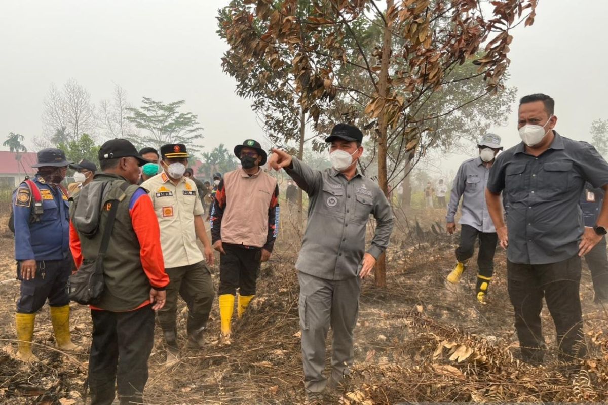
BMKG Supadio Pontianak has detected 2,434 hotspots in West Kalimantan over the last 24 hours and has warned of a high potential for forest and land fires during the upcoming week.
“Regarding hotspots in the West Kalimantan region, 2,434 hotspots have been detected in the last 24 hours,” said BMKG Supadio forecaster Noven in Sungai Raya on Thursday.
Noven stated that this condition requires attention from all parties, as West Kalimantan is forecast to fall into the ‘easy to very easy’ category for burning during the period of 3–9 September 2026.
BMKG forecasts that weather conditions in West Kalimantan on Thursday will be dominated by partly cloudy and cloudy skies, accompanied by haze from morning until night.
According to Noven, winds are generally blowing from the southeast to the south at speeds ranging from 10 to 35 kilometres per hour.
“We forecast that weather in the West Kalimantan region today will be dominated by cloudy conditions, covered by haze from this morning until tonight,” he said.
BMKG has urged the public to increase vigilance regarding rising air temperatures and the reduced potential for rain, which could heighten the risk of forest and land fires.
Based on the forecast for fire susceptibility, parts of West Kalimantan are likely to experience easy to very easy burning conditions until 9 September 202t6.
The public is also expected to refrain from activities that could trigger fire, particularly land clearing through burning, given that weather conditions and drought can accelerate the spread of fires.
BMKG reminds the public to continue monitoring weather developments and hotspot information through the Info BMKG application, the official BMKG Kalbar website, or the agency’s official social media.
Meanwhile, the Governor of West Kalimantan, Ria Norsan, reminded that land burning can have widespread impacts, harming thousands of residents through the threat of haze to health and public activities.
“Please, because it is a pity that due to land burning, thousands of people become victims. The danger of haze and other issues, and even flights cannot proceed because this is near the airport,” he said.
According to Norsan, the vastness of peatlands, difficult terrain, and wind gusts pose significant challenges for officers and volunteers in controlling fires.
“Today we see that in Sekunder C, a peatland fire is occurring. The peatland area here is quite large, so firefighters are overwhelmed in extinguishing it. They have been fighting the fire here for two days,” he added.