
BMKG: South Kalimantan Dominated by Red Zone for Forest and Land Fires on Monday
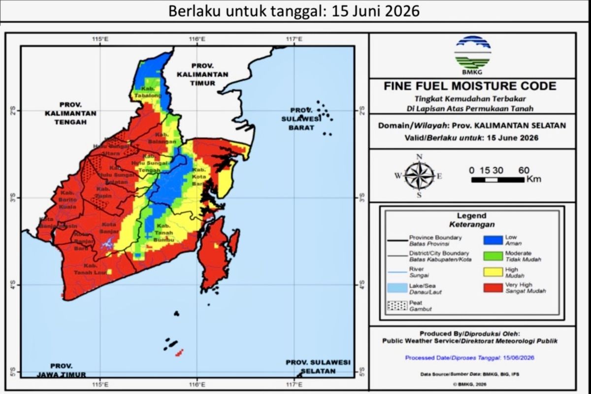
The Meteorology, Climatology, and Geophysics Agency (BMKG) stated that the South Kalimantan region is dominated by a red zone, or a category of very high susceptibility to forest and land fires (karhutla), on Monday.
Weather Forecaster at the Syamsudin Noor Class II Meteorological Station in Banjarmasin, Putri Cahyaningsih, in Banjarbaru on Monday, said that based on spatial data as of 15 June 2026 at 07.00 Wita, the red zone has extensively and almost entirely covered 13 districts/cities, leaving no areas with a low vulnerability level.
Six areas—Banjarmasin City, Banjarbaru City, Barito Kuala Regency, Tanah Laut Regency, Tanah Bumbu Regency, and Kotabaru Regency—are monitored as being in the most vulnerable condition because their entire territories are in the red zone with a very high level of flammability.
Additionally, monitoring results from the Terra, Aqua, Suomi NPP, and NOAA20 satellites detected one medium-category hotspot in Lokpaikat Subdistrict, Tapin Regency, at coordinates Longitude 115.2324 and Latitude -2.9391, indicating heat activity on the land surface.
BMKG urged local governments, disaster management officials, and the public to increase vigilance, tighten field supervision, and avoid activities that could potentially trigger fires amid the ongoing dry weather conditions.