
BMKG Satellite Images Detect Forest and Land Fire Smoke Reaching Jakarta
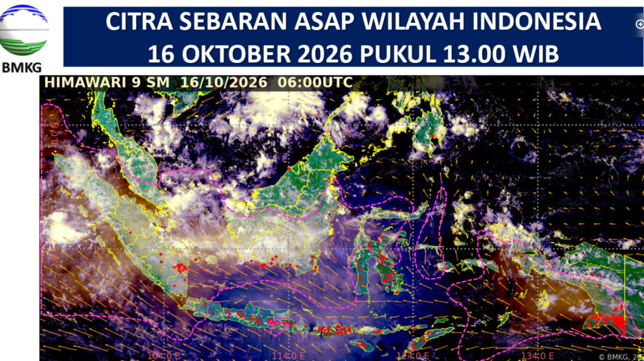
The Meteorology, Climatology and Geophysics Agency (BMKG) has detected smoke from forest and land fires in Kalimantan reaching Jakarta’s atmosphere. The smoke was observed in imagery from the Himawari-9 satellite.
According to the BMKG’s official website, its smoke-distribution imagery at 1pm local time on Friday (16 October) detected smoke in Aceh, North Sumatra, West Sumatra, Riau, Jambi, Riau Islands, Bengkulu, Bangka Belitung Islands, South Sumatra, Lampung, Banten, Jakarta, West Java, East Java, West Kalimantan, Central Kalimantan, South Kalimantan, East Kalimantan, North Kalimantan, South Sulawesi, Southeast Sulawesi, Central Sulawesi, Gorontalo, North Sulawesi, Maluku, North Maluku, Southwest Papua, West Papua, Central Papua, Highland Papua and South Papua.
The satellite images shared by BMKG showed smoke in Aceh, North Sumatra, West Sumatra, Riau, Jambi, Riau Islands, Bengkulu, Bangka Belitung Islands, South Sumatra, West Kalimantan, Central Kalimantan, South Kalimantan, East Kalimantan, Maluku, North Maluku, Southwest Papua, West Papua, Central Papua, Highland Papua and South Papua moving north-west to north-east.
In Banten, Jakarta, West Java, East Java, South Sulawesi, Southeast Sulawesi, Central Sulawesi, Gorontalo and North Sulawesi, it was moving south-east to south-west.
Forest and land fire smoke moving towards Malaysia and Singapore
BMKG also identified the potential for smoke to cross national borders. Smoke from Sumatra and Kalimantan was observed moving towards the Malay Peninsula and Singapore.
Winds were generally blowing from the east to south-east towards the north-west to north. This affected the movement of smoke plumes from Sumatra, Kalimantan and Papua. Meanwhile, smoke in Banten, Jakarta, West Java and parts of Sulawesi was observed moving south-east to south-west.
Hotspots in Indonesia
A total of 1,297 hotspots were recorded across Indonesia, with the highest number in Sumatra. The breakdown was as follows:
Sumatra: 505 hotspots
Kalimantan: 346 hotspots
Papua and Maluku: 330 hotspots
Sulawesi: 66 hotspots
Nusa Tenggara: 38 hotspots
Java: 12 hotspots
Source: jawawa.id (https://jawawa.id/newsitem/bmkg-satellite-images-detect-forest-and-land-fire-smoke-reaching-jakarta-1792144312)
Originally published by VIVA.co.id (https://www.viva.co.id/berita/nasional/1936338-citra-satelit-bmkg-deteksi-sebaran-asap-karhutla-hingga-jakarta), translated from Indonesian