
BMKG Reports 20 Aftershocks Following Magnitude 7.7 Earthquake
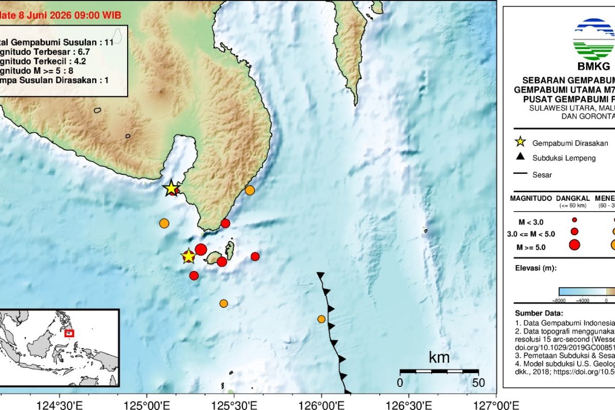
Manado (ANTARA) - The Agency for Meteorology, Climatology, and Geophysics (BMKG) has reported 20 aftershock activities following a main magnitude 7.7 earthquake in the South Coast of Mindanao, Philippines region.
“As of 10:00 WIB, BMKG monitoring results show 20 aftershock activities with magnitudes ranging from 3.9 to 6.7, and two earthquakes were felt,” said Wijayanto, Director of Earthquakes and Tsunamis at BMKG, in an earthquake update received in Manado on Monday.
The earthquake, which occurred at 06:37:42 WIB, impacted Miangas and Melonguane with an intensity of VI MMI (vibrations felt by all residents, wall plaster falling, and factory chimneys damaged). In Siau and Tagulandang, the intensity was V MMI (vibrations felt by almost all residents, objects tossed, and poles seen swaying). In Morotai, North Halmahera, and Manado City, the intensity was IV MMI (vibrations felt by almost all residents, many people awakened). In Batang, Ternate, West Halmahera, Gorontalo, South Halmahera, East Halmahera, Parigi Moutong, Manado, Minahasa, Palu, Bitung, East Bolaang Mongondow, and Central Halmahera, the intensity was III MMI (vibrations clearly felt inside houses, similar to the passing of a heavy truck).
Following observations in the affected areas, no significant rise in sea levels posing a danger was detected, and the tsunami early warning was declared over at 10:15:51 WIB. BMKG continues to monitor aftershock activity and will coordinate with local governments. The agency emphasised that official information should only be sourced from BMKG via verified communication channels.
On Monday, at 06:37:42 WIB, the South Coast of Mindanao, Philippines, was struck by a tectonic earthquake. BMKG analysis indicates the earthquake had a magnitude of M7.7 at a depth of 47 kilometres. The epicentre was located at coordinates 5.80° N; 125.14° E, specifically in the sea at a distance of 244 kilometres northwest of Karatung Island, North Sulawesi.