
BMKG Records 235 Aftershocks in NTT
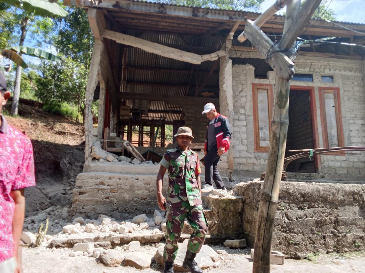
The Meteorology, Climatology and Geophysics Agency (BMKG) has recorded 235 aftershocks as of 14.00 WIB following the main tectonic earthquake north of Flores Island, East Nusa Tenggara. The aftershock activity is distributed north of Flores Island with magnitudes ranging from M2.5 to M6.2.
Monitoring graphs indicate that the current trend of recorded aftershocks has not yet shown significant decay. BMKG Head Teuku Faisal Fathani confirmed that BMKG continues to monitor fault movements in real-time. Based on the history and characteristics of the region, the fault stabilisation process requires a certain time interval before seismic activity truly returns to normal.
“BMKG estimates the natural decay process will take between 2 to 3 weeks, following the pattern of previous damaging earthquake recordings in North Maluku,” said Teuku Faisal during the Emergency Response Coordination Meeting for the NTT Province Earthquake at the BMKG MHEWS Building in Jakarta on Saturday (15/8).
Previously, BMKG confirmed an update of the shallow tectonic earthquake data to M7.7 with a depth of 15 km. The BMKG earthquake monitoring system responded rapidly by issuing a tsunami early warning just 2 minutes and 16 seconds after the main earthquake. Monitoring officers then updated the tsunami early warning after the earthquake parameters stabilised and became precise 10 minutes later. The earthquake tremors triggered tsunami waves that struck several coastal areas.
BMKG tested a multi-scenario running model system and divided the threat status into Siaga (high potential of 0.5 metres to 3 metres) and Waspada (height below 0.5 metres) categories. The sea level observation network recorded tsunami waves arriving in Reo Manggarai and East Manggarai with peak heights reaching 1.61 metres, Maurole Ende at 0.94 metres, and Bulukumba and Sape Bima exceeding 0.5 metres. BMKG officially ended all tsunami early warnings at 07.30 WIB after sea level monitoring confirmed that sea conditions had returned to safe levels.
“This earthquake is classified as a shallow earthquake arising from activity of the Flores Back Arc Thrust,” he stated. Historically, the Flores Back Arc Thrust structure holds a long record of damaging earthquakes, including the M7.8 earthquake at a depth of 28 km that struck the region in 1992. The difference with this earthquake is that it was centred at a much shallower depth of 15 km, causing relatively severe physical damage to infrastructure buildings and triggering a tsunami observed as far as the coasts of South Sulawesi and Southeast Sulawesi.
Based on the intensity map, BMKG recorded the strongest shaking reaching scale VII MMI in Aesesa (Nagekeo Regency), Riung (Ngada Regency), Ambai City, as well as direct micro-observation results in the Manggarai and Ruteng areas. Scale VI MMI was measured in Wolowae (Nagekeo) and Bajawa City, while scale V MMI was felt in several surrounding areas.
To support post-disaster recovery and reconstruction, BMKG has deployed expert teams to manage microzonation mapping surveys and macro-analysis. The central BMKG team together with 14 BMKG Technical Implementation Units across NTT are surveying the Ngada, Nagekeo and other vulnerable points on Flores Island. The micro-analysis survey aims to measure soil types and responses to earthquakes. BMKG will directly submit the field analysis results to stakeholders as the main technical reference for laying the foundation for reconstruction and retrofitting of earthquake-resistant building structures.
“BMKG urges the public to always trust official reference data sourced from the national network supported by more than 2,000 seismic sensors, including 553 special seismograph sensors throughout Indonesia,” he concluded.