
BMKG Outlines Worst-Case Megathrust Scenarios, Including Major Earthquakes and Tsunamis
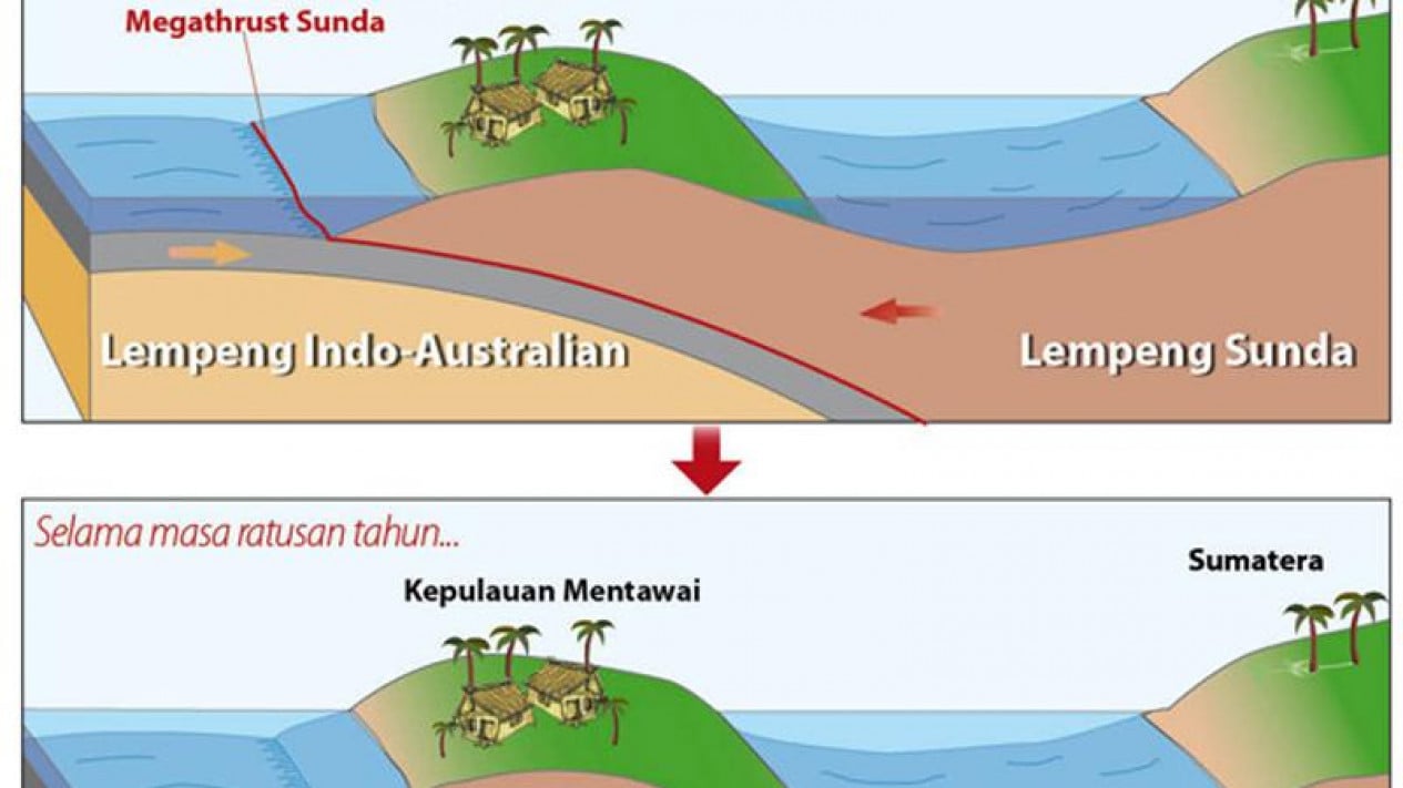
Indonesia is situated at the meeting point of several of the world’s active tectonic plates. This geographical position results in high tectonic activity throughout the Indonesian territory, including the presence of numerous subduction zones stretching across the region.
This condition makes Indonesia one of the countries with a high potential for earthquakes. Continuous plate movement can trigger various seismic activities, ranging from minor tremors to major earthquakes.
One tectonic area of particular concern is the megathrust zone. The existence of these zones is frequently linked to the potential for large-scale earthquakes and tsunamis.
Amidst renewed discussions on the subject, the Meteorology, Climatology, and Geophysics Agency (BMKG) has provided an explanation regarding Indonesia’s megathrust zones, the potential for earthquakes, and an outline of the worst-case scenarios that must be anticipated as part of disaster mitigation efforts.
Quoting BMKG’s official Instagram account on Sunday, 27 September 2026, it was explained that a megathrust is an earthquake source in a subduction zone where two tectonic plates meet and subduct at shallow depths, generally less than 50km. This zone can accumulate massive amounts of energy and trigger powerful earthquakes with extensive fault planes.
“Tectonically, Indonesia possesses 14 segments of megathrust earthquake sources with a maximum potential magnitude between M7.8 and M9.2,” stated the official BMKG website.
Based on the 202<0xC2>4 Indonesian Earthquake Source and Hazard Map compiled by the National Earthquake Study Centre (PuSGeN), there are 14 megathrust segments acting as earthquake sources in Indonesia and its surrounding areas. Of these fourteen, one segment with the largest potential maximum magnitude is the Aceh-Andaman Megathrust, which can reach M 9.2.
The following are the 14 megathrust segments in Indonesia as detailed by BMKG based on PuSGeN 2024:
Aceh-Andaman, maximum potential magnitude M 9.2
Nias-Simeulue, maximum potential magnitude M 8.7
Batu, maximum potential magnitude M 7.8
Mentawai-Siberut, maximum potential magnitude M 8.9
Mentawai-Pagai, maximum potential magnitude M 8.9
Enggano, maximum potential magnitude M 8.9
Java, maximum potential magnitude M 9.1
Western Java, maximum potential magnitude M 8.9
Eastern Java, maximum potential magnitude M 8.9
Sumba, maximum potential magnitude M 8.5
Northern Sulawesi, maximum potential magnitude M 8.6
Cotobato Trench, maximum potential magnitude M 8.3
Central Philippine, maximum potential magnitude M 8.1
South Philippine, maximum potential magnitude M 8.2
Source: jawawa.id (https://jawawa.id/newsitem/bmkg-outlines-worst-case-megathrust-scenarios-including-major-earthquakes-and-tsunamis-1790488410)
Originally published by VIVA.co.id (https://www.viva.co.id/berita/nasional/1931408-bmkg-beberkan-skenario-terburuk-megathrust-gempa-besar-hingga-tsunami), translated from Indonesian