
BMKG: M5.2 earthquake in Flores has no tsunami potential
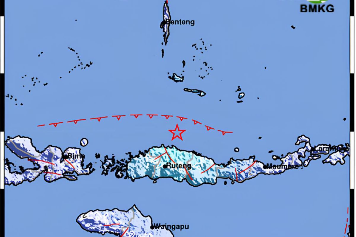
The Meteorology, Climatology and Geophysics Agency (BMKG) has stated that a tectonic earthquake with a magnitude of 5.2 occurred on Saturday at 09:31:01 WITA in the Flores Island region of East Nusa Tenggara and does not have tsunami potential.
BMKG analysis shows the earthquake has updated parameters with a magnitude of M5.1 at a depth of 16 km. Tsunami modelling results indicate that this earthquake does not have tsunami potential, said BMKG Director of Earthquakes and Tsunamis Wijayanto in a statement received in Kupang on Saturday.
He explained that the earthquake epicentre is located at coordinates 8.07° S; 120.66° E, precisely in the sea at a distance of 64 km northeast of Ruteng, Manggarai, East Nusa Tenggara.
Taking into account the epicentre location and hypocentre depth, the earthquake is a shallow earthquake caused by Flores Back-Arc Thrust activity.
Source mechanism analysis shows that the earthquake has a thrust fault movement mechanism.
The earthquake is part of the aftershock sequence from the M7.7 earthquake in Flores, East Nusa Tenggara on 15 August 2026 at 06:58:23 WITA.
Wijayanto said that as of 22 August 2026 at 09:00:00 WITA, BMKG monitoring results show 5,089 aftershock activities, with the largest magnitude being M6.2.
BMKG confirmed it will continue to monitor aftershock activity and provide updated information to stakeholders and the public.
The public is urged to remain calm and not be influenced by unverified information, and to avoid buildings that are cracked or damaged due to the earthquake.
Source: jawawa.id (https://jawawa.id/newsitem/bmkg-m5-2-earthquake-in-flores-has-no-tsunami-potential-1787370743)
Originally published by Antara (Indonesian) (https://www.antaranews.com/berita/5706280/bmkg-gempa-m52-di-flores-tidak-berpotensi-tsunami), translated from Indonesian