
BMKG: M 7.7 Earthquake in Mindanao, Philippines Caused by Plate Subduction
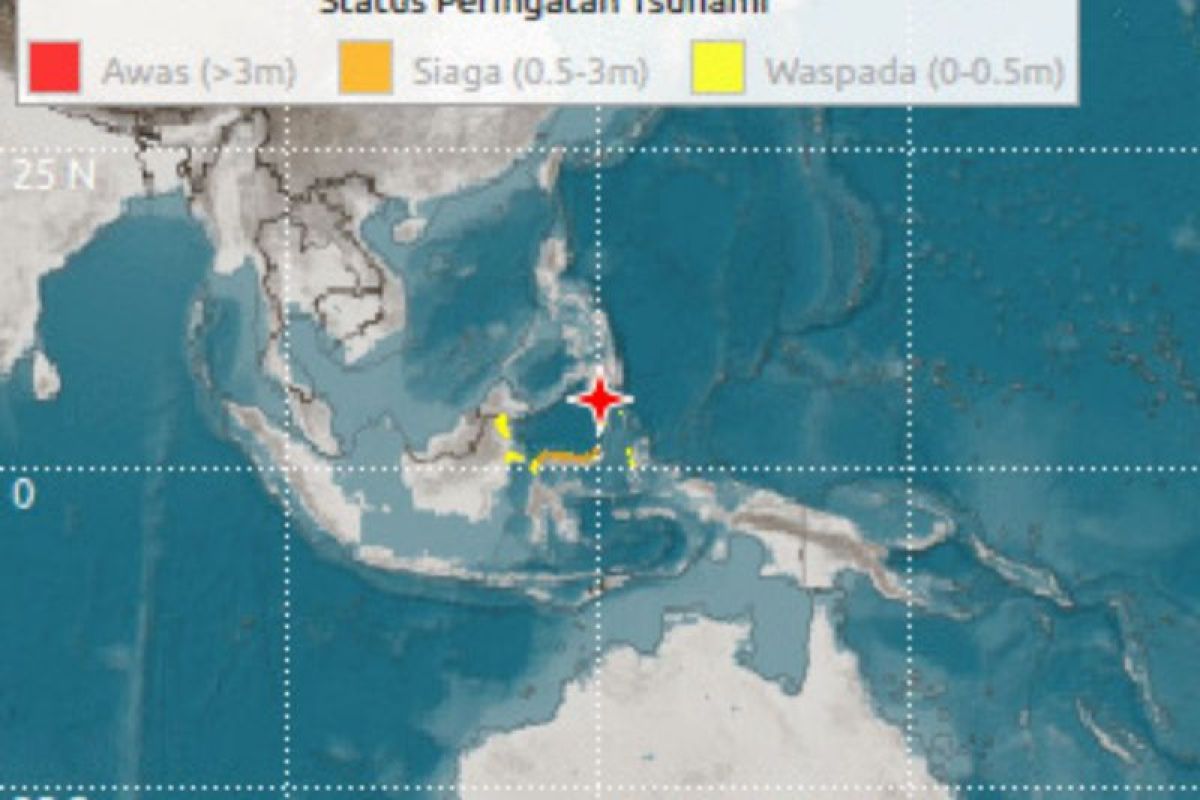
The Meteorology, Climatology, and Geophysics Agency (BMKG) stated that the magnitude 7.7 tectonic earthquake that struck the southern coast of Mindanao, Philippines, on Monday morning at 06:37 WIB was caused by plate subduction activity.
“Observing the location of the epicentre and the depth of the hypocentre, the earthquake that occurred is a shallow earthquake type resulting from plate subduction activity,” said Wijayont, Director of Earthquakes and Tsunamis at BMKG, in a release shared via the ‘BMKG and Stakeholders’ communication group in Manado on Monday.
Source mechanism analysis indicates that the earthquake involved a thrust fault movement. The tremors were felt in Morotai City, North Halmahera, with an intensity of IV MMI, and in North Gorontalo Regency with an intensity of III-IV MMI. Other areas, including Ternate, Gorontalo, Manado, Palu, and Bitung, experienced an intensity of III MMI, where vibrations were noticeably felt inside buildings.
As of now, there have been no reports of damage caused by the earthquake. However, tsunami modelling indicates a potential tsunami status of ‘Siaga’ (Alert) for Minahasa, Bolaang Mongondow, Manado, North Minahasa, South Minahasa, Buol, Sangihe Islands, Gorontalo, Talaud Islands, Minahasa Islands, Toli-toli, Palu, Donggala, Ternate, and Bitung. A ‘Waspada’ (Warning) status has been issued for Tidore, Bulungan, Nunukan, Halmahera, Tarakan, North Halmahera, East Kutai, South Minahasa, Bontang, and Berau.
In response to this potential, BMKG has recommended that residents in ‘Alert’ areas immediately move away from the coast to higher ground, while those in ‘Warning’ areas are advised to stay away from the coast and riverbanks.
As of 07:11 WIB, BMKG monitoring recorded two aftershocks with magnitudes of M 6.7 and M 5.9. The agency urged the public to remain calm and to ensure that official information is sourced only from verified BMKG communication channels. The earthquake’s epicentre was located at coordinates 5.80° N; 125.14° E, in the sea approximately 244 kilometres northwest of Karatung Island, North Sulawesi, at a depth of 47 kilometres.