
BMKG Explains Cause and Type of M6.4 Earthquake That Shook Simalungun
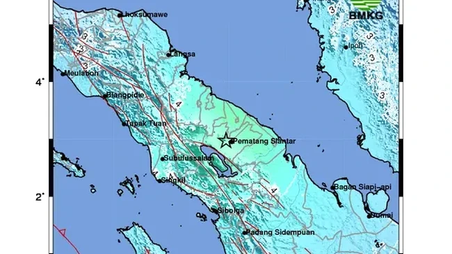
A magnitude 6.4 earthquake shook the Simalungun region of North Sumatra on Saturday, 15 August 2026, at 17:54:52 WIB.
“BMKG analysis shows this earthquake has updated parameters with a magnitude of M6.4 at a depth of 168 km. The epicentre is located at coordinates 2.91 degrees north latitude, 98.93 degrees east longitude, precisely on land 11 km southeast of Simalungun, North Sumatra,” said BMKG Director of Earthquakes and Tsunamis Wijayanto in his statement.
“Tsunami modelling results show that this earthquake has NO TSUNAMI POTENTIAL,” he added.
He also explained the cause and type of the earthquake.
“Taking into account the epicentre location and hypocentre depth, the earthquake that occurred is a medium-depth earthquake due to plate subduction activity,” he said.
“Source mechanism analysis shows that the earthquake has an oblique normal fault mechanism,” Wijayanto explained.
Based on shakemap estimates, the earthquake was felt at the following intensity scales:
V MMI (vibrations felt by almost all residents, many people awakened) in Tebingtinggi City, Kabanjahe City, Limapuluh City
IV MMI (felt by many people indoors during the day) in Raya, Panombeian Pane, Panei (Simalungun), Pematangsiantar City, Pangururan City.
“As of 18:16:00 WIB, BMKG monitoring has not shown any aftershock activity,” he said.
BMKG will continue to monitor aftershock activity and provide updated information to stakeholders and the public.
Wijayanto urged residents to remain calm and not be influenced by unverified information, and to avoid buildings that are cracked or damaged due to the earthquake.