
BMKG Ends Tsunami Early Warning for North Sulawesi and North Maluku
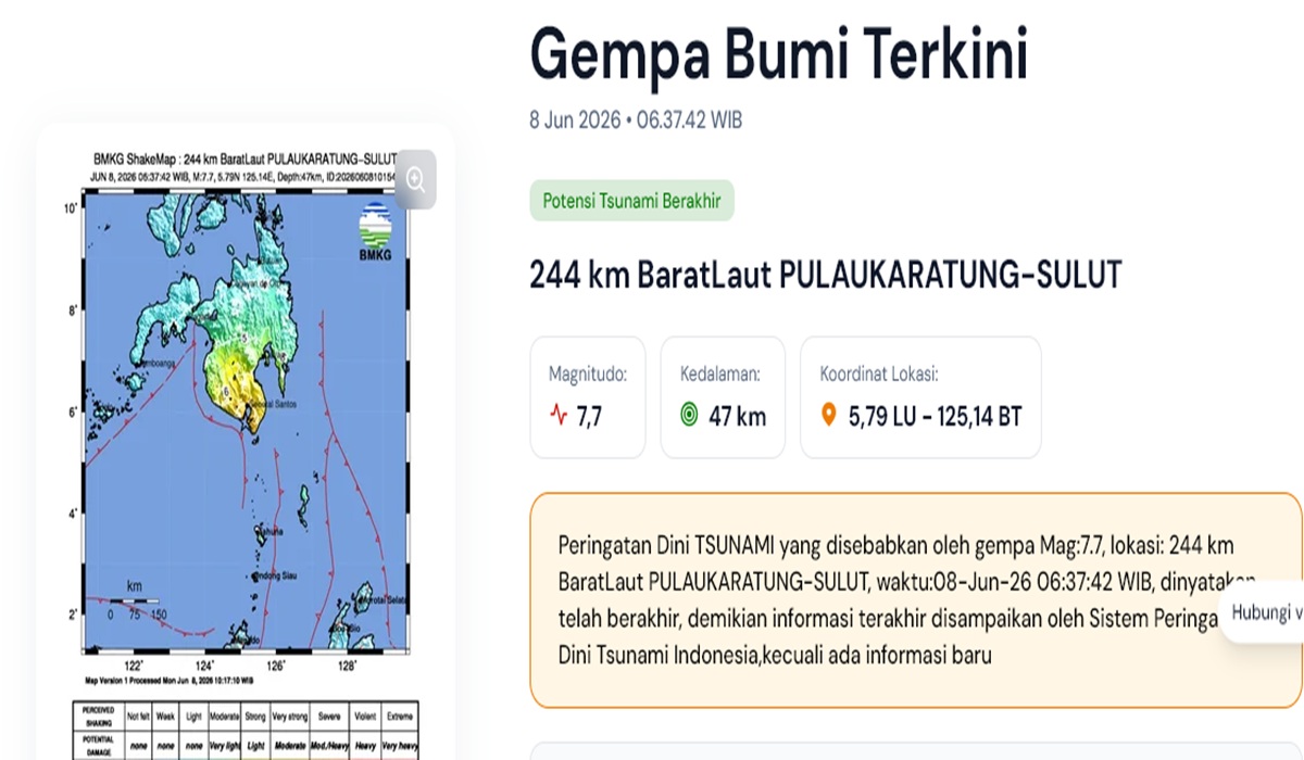
The Meteorology, Climatology, and Geophysics Agency (BMKG) has officially ended the tsunami early warning triggered by a magnitude 7.7 tectonic earthquake at the South Coast of Mindanao, Philippines, on Monday (8/6). Following the earthquake in the Philippines, tsunamis were detected in several coastal areas of North Sulawesi, Central Sulawesi, and North Maluku, with varying wave heights reaching up to 75 centimetres.
BMKG Chairman Teuku Faisal Fathani stated that the tsunami early warning was lifted at 10:15:51 WIB after observations indicated no further significant or dangerous rises in sea levels. “Taking into account the current conditions based on observations in several affected areas, there are no longer significant sea level rises that pose a danger. Therefore, the tsunami early warning is declared ended at 10:15:51 WIB,” Faisal said during a press conference.
The magnitude 7.7 earthquake occurred at 06:37:42 WIB, with the epicentre located at sea at coordinates 5.80 degrees North latitude and 125.14 degrees East longitude, approximately 244 kilometres northwest of Karatung Island, North Sulawesi, at a depth of 47 kilometres.
BMKG noted that the tsunami was first detected in Loloda, North Maluku, at a height of 9 centimetres at 07:20 WIB. Waves were subsequently measured at 18 centimetres on Siau Island and 32 centimetres in Melonguane, North Sulawesi. Subsequent monitoring detected waves of 30 centimetres in Tahuna, 45 centimetres in Paleleh, Central Sulawesi, 32 centimetres in Tanjung Sidupa, 29 centimetres in Bitung, and 14 centimetres in Ternate. The highest wave was recorded in Palangeng, Sangihe Islands Regency, North Sulawesi, reaching 75 centimetres at 08:20 WIB.
According to Faisal, BMKG issued four stages of tsunami early warnings in accordance with standard operating procedures. The first warning, containing earthquake parameters and threat status, was released just three minutes after the earthquake, followed by updates on parameters and sea level observations in subsequent stages.
In addition to triggering tsunamis, the earthquake was felt in several parts of Indonesia. The strongest tremors, with an intensity of V MMI, were recorded in Miangas and Melonguane. Similar intensities were felt in Siau and Tagulandang. As of 10:00 WIB, BMKG had recorded 20 aftershocks with magnitudes ranging from 3.9 to 6.7.
BMKG has urged the public to remain calm and to only access official information through BMKG communication channels to avoid the spread of unverified information.