
BMKG: Alert for waves up to 4 metres in North Sumatra from 19-22 September
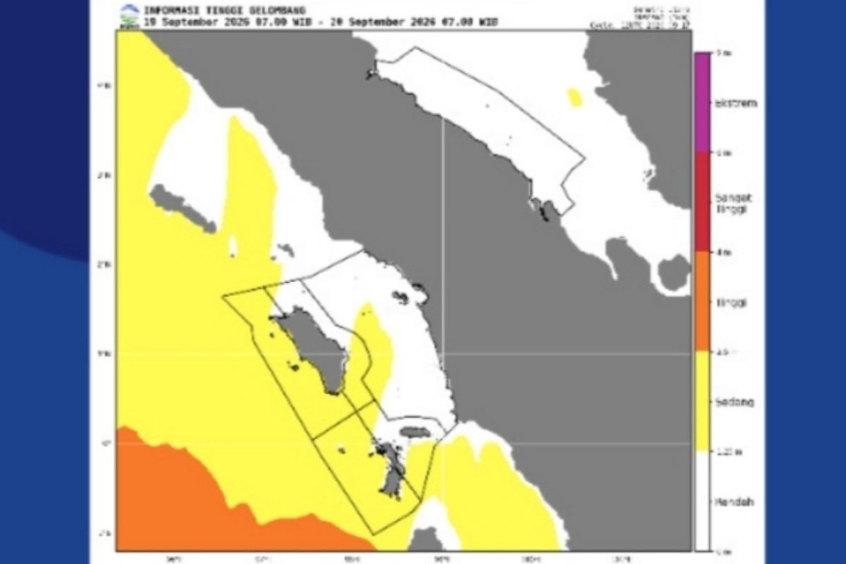
Be wary of sea waves that can reach 2.5 to 4 metres, as they may disrupt shipping. The Meteorology, Climatology, and Geophysics Agency (BMKG) has warned fishermen and other stakeholders to remain vigilant regarding the potential for four-metre waves in several areas of North Sumatra.
“Be wary of sea waves that can reach 2.5 to 4 metres because they can disrupt navigation. These conditions may occur from 19 to 22 September 2026,” said Christen Marpaung, a forecaster at the BMKG Class II Maritime Meteorological Station Belawan, in Medan on Friday.
Sea waves reaching up to four metres are likely to occur in the Indian Ocean west of the Nias Islands, and the waters west of the Batu Islands. Meanwhile, waves between 1.25 and 2.5 metres are expected in the Batu Islands waters, the western waters of North Sumatra, and the eastern waters of the Nias Islands.
Ferry operators have also been advised to increase vigilance if wind speeds reach 21 knots and wave heights reach 2.5 metres.
The activity of the Rossby and Kelvin Equatorial Waves, along with the presence of wind shifts and convergence, can support convective activity in the North Sumatra region, Marpaung added. These conditions can contribute to the formation of rain clouds across the province.
Wind patterns in North Sumatran waters generally move from southeast to west, with wind speeds ranging between 2 and 30 knots. The highest wind speeds in the northern part of Sumatran waters were observed in the northern Malacca Strait.