
Basarnas Deploys Thermal Drones to Search for Speedboat Carrying Journalists to Anak Krakatau
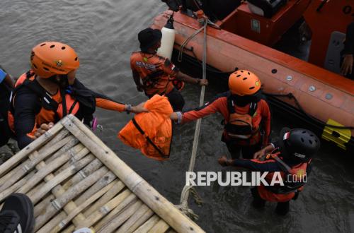
The joint Search and Rescue (SAR) team is continuing its search for the Arupadhatu 1 speedboat, which lost contact in the waters of the Sunda Strait, Pandeglang Regency, Banten. Eight individuals on board the speedboat, including five photojournalists, remain missing.
The Head of the Banten Search and Rescue Office, Al Amrad, stated that the search will be optimised through sector division and the deployment of various SAR elements, including Basarnas, the TNI (Indonesian National Armed Forces), the Polri (National Police), and other potential SAR contributors. His office has also deployed thermal drones to assist the search process.
“The search is supported by two Basarnas thermal drone units, alongside monitoring of the Enggano Island coastal area and Bengkulu waters through coordination with the Bengkulu SAR Office,” he said in a statement on Wednesday (16/09/2026).
He explained that on the ninth day of the SAR operation, the joint team deployed 22 primary maritime rescue assets. The search area has been divided into eight maritime sectors, covering a total area of approximately 3,439 square nautical miles.
Amrad noted that Sector A, covering 511 square nautical miles, will be swept by KRI Dewa Kembar and KP Sanjaya. Sector B, spanning 539 square nautical miles, involves KN SAR Basudewa, while Sector C, covering 585 square nautical miles, will be handled by KRI Leuser.
In Sector D, covering 319 square nautical miles, the search involves KN SAR Antasena and KRI Lepu. Sector E, spanning 271 square nautical miles, will be patrolled by RIB 02 Lampung and KAL Pahowang, while Sector F, covering 265 square nautical miles, involves several KP Polairud vessels.
Sector G, covering 282 square nautical miles, will be covered by KAL Anyer, RBB Pulau Peucang, and RIB 02 Banten. Meanwhile, Sector H, spanning 667 square nautical miles, involves KN SAR Tetuka, KRI Kerambit, KRI Teluk Gilimanuk, and KN Damaru.
Amrad stated that in addition to maritime search efforts, the joint SAR team has prepared two Basarnas thermal drones to support aerial monitoring. The use of drones is expected to assist in identifying the potential location of victims, boat debris, or other objects related to the incident.
The joint SAR team has also coordinated with the Bengkulu SAR Office to conduct searches and monitoring along the coast of Enggano Island and the Bengkulu waters. This step is an anticipatory measure against the possibility of victims or objects being carried by sea currents.
He added that all SAR elements continue to prioritise personnel safety, taking into account weather conditions and field developments. On the ninth day of the operation, weather conditions are expected to be partly cloudy, with winds blowing from the southeast at speeds of 10 to 20 knots and wave heights ranging from 0.5 to 3.5 metres.
“We will continue to follow up on any information potentially related to the whereabouts of the eight victims. All elements are instructed to carry out the search to the maximum extent, remain vigilant regarding wind and wave conditions, and prioritise safety during the operation,” he said.
It is reported that eight people are missing in the incident. The victims include Warta (the ship captain), Surakman (crew member), Heriyanto (guide), and five journalists: M. Bagus Khoerunnas from Antara, Arie Basuki from Merdeka, Yudhistiro Pranoto from iNews, Firdaus Wajidi from Anadolu, and Donal Husni, a freelance journalist.