
Are Indonesia's 4 Volcano Eruptions Connected? What Expert Says
Are Indonesia’s 4 Volcano Eruptions Connected? What Expert Says
Reporter
September 8, 2026 | 06:35 pm
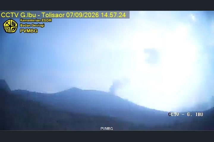
TEMPO.CO, Jakarta - Several volcanoes across Indonesia have erupted in rapid succession. As of Monday and through Tuesday, September 8, 2026, three volcanoes have been recorded erupting: Mount Ibu, Mount Ili Lewotolok, and Mount Semeru.
Mount Semeru is located in East Java, Mount Ili Lewotolok in East Nusa Tenggara, and Mount Ibu in North Maluku. These eruptions coincided with heightened activity at Mount Anak Krakatau. The status of the Sunda Strait volcano was raised to Alert in early July, following continuous eruptions reported from September 4 to 6.
Continuous eruptions ejecting massive ash plumes have drifted across western Java and parts of Sumatra. The Geological Agency of the Ministry of Energy and Mineral Resources noted that eruptive activity remains ongoing. According to seismic logs on the MAGMA Indonesia portal, Anak Krakatau erupted three times on Tuesday morning at 5:08 a.m., 5:34 a.m., and 7:49 a.m. WIB.
Indonesian Association of Disaster Experts (IABI) member Daryono emphasized that concurrent eruptions across multiple volcanoes are a natural feature of tectonic dynamics within the Ring of Fire subduction zone. Such occurrences are generally a matter of spatial and temporal coincidence.
“Indonesia is located in an active subduction system with dozens of active volcanoes that are on alert or vigilant status,” Daryono said in a written statement on Monday, September 7, 2026. He explained that Indonesia sits in a complex convergence zone where the Indo-Australian, Pacific, and Philippine Plates subduct beneath the Eurasian Plate.
According to Daryono, although four volcanoes currently show increased activity simultaneously, no mechanism, such as an underground magma channel network, connects their magma chambers. He made the statement in response to illustrations circulating on social media depicting interconnected magma chambers among the four volcanoes.
Daryono also denied claims that the eruptions were caused by technological manipulation or weapons, calling the assertions entirely illogical in terms of earth science. In geological, tectonic, and geophysical terminology, Daryono explained that volcanic eruptions represent a massive release of endogenic energy from the earth, “which is impossible to be simulated, generated, or controlled by any human-made technology.”
He noted that the energy required to trigger eruptions stems from Earth’s mantle dynamics at depths of tens to hundreds of kilometers below the surface, where magma chamber pressure reaches hundreds of megapascals. According to him, no electromagnetic wave technology or human-made explosions can penetrate the Earth’s crust to intentionally alter the pressure of such silicate fluids.
“These simultaneous eruptions are purely because each volcanic system has reached a critical stage of fluid pressure and magma accumulation within them,” he stated.
According to the geography doctorate holder, who previously served as Director of Earthquakes and Tsunamis at the Meteorology, Climatology, and Geophysics Agency (BMKG), when several volcanoes coincidentally reach the threshold of gas and magma saturation at nearly the same time, they erupt individually without direct triggering from one another.
Daryono explained that eruption dynamics, magma viscosity, and volcanic gas content account for the differing ash column heights across eruptions. The eruption of Mount Anak Krakatau, which spread volcanic ash to Banten, Jakarta, West Java, Lampung, and Bengkulu, indicates a high volume of ejected material reaching the middle and upper troposphere, which is then distributed by regional wind patterns like monsoon winds.
Meanwhile, eruptions at Mount Semeru with a 1,000-meter ash column, Mount Ili Lewotolok with a 600-meter column, and Mount Ibu with a 400-meter column feature more localized energy intensity. “The height of the ash column is influenced by the strength of gas pressure in the vent channel and thermal buoyancy force in the eruption column when interacting with the surrounding air mass.”
Daryono stated that the characteristics of ash waves and ejected materials are also shaped by physical and chemical factors, including the proportion of silica (SiO2) and volatile compositions like water (H2O), carbon dioxide (CO2), and sulfur dioxide (SO2). Magma with high viscosity and abundant gas content tends to produce explosive eruptions that shatter magma into sub-millimeter volcanic ash particles, which are then carried by tropospheric winds.
Conversely, volcanoes with more fluid magma or open vents tend to release gas pressure repeatedly through moderate eruption columns. The impact of these eruptions thus remains largely confined to the immediate vicinity of the main crater.
Read: Geological Agency: Anak Krakatau Eruption Returns to Strombolian Phase
Click here to get the latest news updates from Tempo on Google News