
Andalas University Academics Discover Divergent River Mouth Conditions Following Floods
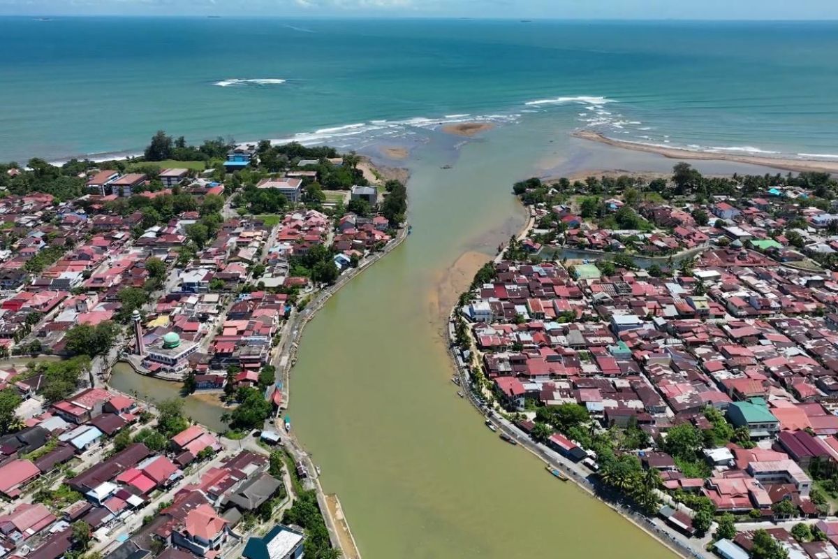
Padang (ANTARA) - Academics from Andalas University (Unand) have discovered differing conditions at the mouths of the Batang Kuranji river in Padang City and the Batang Anai river in Padang Pariaman Regency, West Sumatra, following major floods in November 202 Му5.
“Post-disaster, I have observed different developments at both river mouths. The material carried by the floods has undergone processes and formed patterns that are not identical between the two rivers,” said Professor Mas Mera, Professor and Head of the Fluid Mechanics and Hydraulics Laboratory of Civil Engineering at Unand, in Padang on Thursday.
These differences are evident in the varying morphological changes of both river mouths in response to flood sediment supply and sea wave energy.
He stated that based on aerial observations using drones on 8 and 25 August 2026, the massive landmasses have been decomposed and fragmented by sea waves into clusters of sand islands or mounds, and long ridges of sand or mud forming along the coastline and river mouths (sandbars).
“Deposits that were previously unified have begun to break apart due to sea wave activity. Now, several separated sections of sand are visible in the estuary area,” he said.
The Batang Kuranji flow has proven to still possess an effective natural self-flushing capacity, particularly when peak flood discharge coincides with the ebb tide phase. This condition causes bottom sediments to be pushed out into the open sea. Consequently, management in this area should be directed towards estuary cleaning and the construction of protective jetties, rather than mechanical dredging in the main downstream river body.
Meanwhile, a different condition was observed at the Batang Anai estuary, located near Minangkabau International Airport (BIM).
Drone footage from 28 July and 26 August 2026 shows that the remaining flood sediments did not decompose into sand islands but instead persisted, forming a cape or sand spit on the right or northern side of the estuary, curving towards the left.
“Unlike the condition at Batang Kuranji, the deposits at the Batang Anai estuary persist and form an elongated sandy landmass. From our observations, these deposits form a type of sand spit that curves towards the southern part of the estuary,” he said.
Based on historical Google Earth satellite imagery from July 2025, the natural pattern of coastal sediment transport in the area moved from south to north. This was marked by the formation of 300-metre sandbars growing from the southern side of the estuary towards the north, partially covering the mouth of the estuary.
However, following the 2025 floods through to August 2026, the direction of the turbid water flow and sediment in Batang Anai has shifted towards the south. This local change is influenced by the interaction between large river flood discharge and the new geometry of the sand spit, which alters the refraction of incoming waves in front of the estuary.
The differing hydro-sedimentological characteristics of these two river mouths must be a critical consideration in drafting spatial planning and coastal engineering policies in West Sumatra.
Sedimentation management cannot be implemented using a single approach for all rivers in the West Sumatran coastal region, as wave characteristics, coastal current directions, and estuary geometries differ at every location, affecting the resulting sedimentation patterns.
For the Batang Kuranji estuary, management can focus on ensuring smooth flushing towards the open sea through the opening of estuary reefs and the construction of protective jetties.
For the Batang Anai estuary, the formation of the sand spit and the change in coastal current direction towards the south need to be monitored regularly to prevent coastal erosion (abrasion), given its proximity to vital infrastructure, namely BIM.
He added that the study of both river mouths demonstrates the importance of integrating river hydraulics and coastal engineering processes into flood disaster mitigation planning and coastal spatial planning in West Sumatra.