
Alert! Forest and Land Fire Hotspots in Three Kalimantan Provinces Surge Fourfold
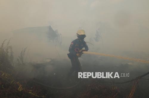
The government is strengthening integrated operations to control forest and land fires (karhutla) in West Kalimantan, Central Kalimantan, and South Kalimantan. This follows a more than fourfold increase in high-confidence hotspots within a single day.
Based on an update from the Ministry of Forestry’s Forest and Land Fire Monitoring System (SIPONGI) using NASA-MODIS/Terra-Aqua satellite monitoring, there were 518 high-confidence hotspots across the three provinces on 19 August 2026 at 07.00 WIB. This figure rose sharply from 109 hotspots on 18 August.
In its statement on Thursday (20/8/2026), the Ministry of Forestry revealed that West Kalimantan recorded the highest number of hotspots, with 259 points. It was followed by Central Kalimantan with 242 points and South Kalimantan with 17 points. Cumulatively, between 17 and 19 August, there were 750 high-confidence hotspots across the three provinces.
On 17 August, the number of hotspots stood at 123 points, comprising 93 in West Kalimantan, 28 in Central Kalimantan, and two in South Kalimantan. A day later, the total fell to 109 points, but a significant shift in distribution occurred. Hotspots in West Kalimantan dropped to 15 points, while Central Kalimantan rose to 73 points and South Kalimantan to 21 points.
The government cautioned that a surge in hotspots does not automatically indicate the number of fire incidents. A single fire event can be detected as several hotspots, so each point must still be verified through field checks.
Verification is necessary to ascertain actual conditions, including location, cause, and the extent of the burned area. The high-confidence category indicates a greater degree of certainty regarding a thermal anomaly, but it cannot be directly equated with the number of fire points or the number of forest and land fire incidents.
The government also reminded that hotspot counts should not be used directly to describe the density of smoke haze. Smoke distribution is influenced by the location of fires, wind direction and speed, humidity, atmospheric conditions, land characteristics, and the accumulation of smoke from several areas.
Therefore, hotspot data needs to be read together with meteorological data, air quality data, smoke distribution imagery, and field reports to obtain a more complete picture of conditions.
The surge in hotspots coincided with public reports of smoke haze and limited visibility in several areas. The government received various reports, including videos and information from Sungai Tabuk, Banjarbaru, Banjarmasin, Palangka Raya, and Pontianak.
Information from the public is used as input to direct patrols, field inspections, fire suppression, and protection of residents in affected areas. The government stated that it understands public concerns and ensures that incoming reports are handled seriously.
However, the government stressed that visual reports from the public describe conditions at a specific location and time. Such information does not necessarily indicate the same conditions across all of Kalimantan. For official information on visibility, the public is asked to refer to data from BMKG, airport authorities, or other authorised agencies.
Source: jawawa.id (https://jawawa.id/newsitem/alert-forest-and-land-fire-hotspots-in-three-kalimantan-provinces-surge-fourfold-1787237579)
Originally published by Republika (https://esgnow.republika.co.id/berita/tk2luw423/waspada-titik-panas-karhutla-di-tiga-provinsi-kalimantan-melonjak-empat-kali-lipat), translated from Indonesian