
Aerial View of Palm Oil Firm Damaging the Banks of the Nilo River Tributary in Riau
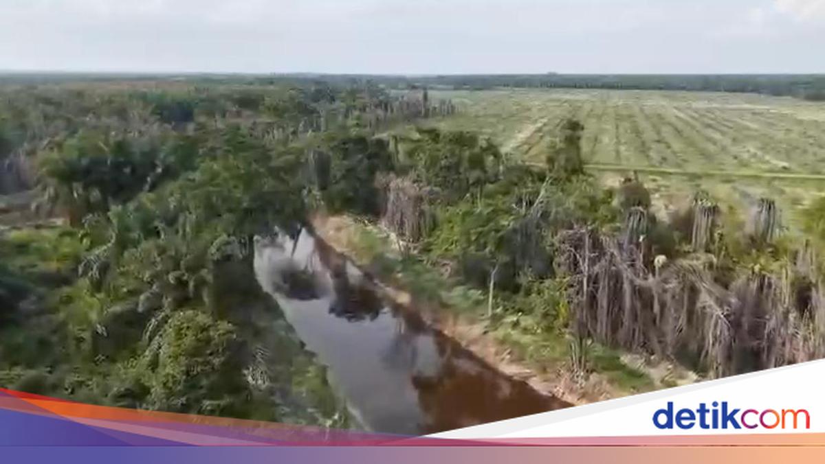
From photos obtained by detikcom, the riverbank area has been planted with oil palm, with some trees already withered. The palm oil trees stretch along the riverbank for about 29,000 hectares.
AKBP Teddy, head of the Tipidter Sub-Directorate of the Directorate of Special Criminal Investigation (Ditreskrimsus) of the Riau Regional Police, said PT MM deliberately had them killed by the company. ‘The trees that have dried were deliberately killed by the company,’ he told reporters on Tuesday, 19 May 2026.
Earlier, Kombes Ade Kuncoro Wahyu, Director of Reskrimsus, explained that a planning expert found that the palm plantation area lies within forest area that overlaps with PT MM’s HGU. The location is in Estate IV Division F of PT MM, Desa Air Hitam, Ukui District, Pelalawan Regency.
‘Our investigation found facts relating to planning that the coordinates at the crime scene lie in forest land overlapping PT MM’s HGU. Then, from the environmental expert, at the crime scene there was oil palm cultivation in a condition that has yellowed leaves and some still green,’ Ade said.
Field visualisation shows that PT MM’s palm plantations did not observe the river boundary line.
‘The on-the-ground facts show oil palm trees along the river boundary,’ he said.
Referring to Ministerial Regulation No. 28 of 2015 by the Ministry of Public Works and Public Housing (PUPR), Article 6(1-3), which regulates the distance of the river boundary: small rivers 50 metres and large rivers 100 metres.
‘On-site, the distance of the palm trees from the river boundary was only 2 to 5 metres. Palm trees are also not a type of plant permitted to be grown on riverbanks,’ he explained.
Erosion and land collapse occurred.
Police also uncovered environmental damage along the riverbank planted with palm oil owned by PT MM, including landslides with depths of 1-2 metres, subsidence, erosion of 10-15 cm depth and 50-60 cm width, and the loss of indigenous vegetation or 0 per cent.
Meanwhile, laboratory tests on soil samples confirmed that the soil damage parameters (clay and sand fractions) had exceeded the threshold for environmental damage. ‘Lab results confirm that the soil damage parameters have exceeded the environmental damage standard,’ he added.