
Activity at Mount Lewotolok declines, alert level remains at 2
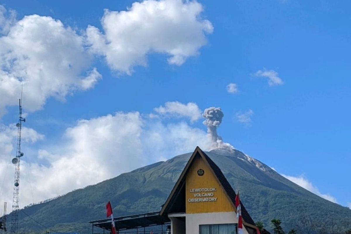
Stanislaus Ara Kian, an observer at the Lewotolok monitoring post, said Monday that the Geological Agency’s evaluation found eruptions and gas emissions had declined, with ash columns reaching 600 meters above the summit.
“Visual observations from July 16-31 showed declining eruption and gas-emission activity. Eruption columns reached 600 meters, while gas plumes reached 200 meters above the summit,” he said.
Eruptions were occasionally accompanied by weak to moderate rumbling and booming sounds. Officials also observed glowing material at the summit and incandescent fragments falling into the crater.
No lava flows were observed during the period, according to the monitoring post.
Seismic monitoring recorded 821 eruption earthquakes, four avalanche earthquakes, 1,312 gas-emission earthquakes, 15 harmonic earthquakes and 17 nonharmonic tremors during the period.
It also recorded two low-frequency earthquakes, four hybrid earthquakes, seven shallow volcanic earthquakes, 27 deep volcanic earthquakes, 10 local tectonic earthquakes and nine distant tectonic earthquakes.
The Geological Agency said overall seismic activity declined during the period, with gas-emission earthquakes dominating the seismic recordings.
Shallow and deep volcanic earthquakes remained relatively stable. Their occurrence indicates rock fracturing caused by magma moving from deeper areas toward shallower depths.
“This condition could increase pressure within Mount Lewotolok,” Stanislaus said.
Fluctuations in slope distances
Electronic Distance Measurement monitoring showed fluctuations in slope distances that generally tended to increase.
Deformation monitoring also indicated deflation, or contraction of the volcano, likely linked to the substantial amount of eruptive material released during ongoing volcanic activity.
The Geological Agency advised residents and tourists not to enter or conduct activities within two kilometers of Mount Lewotolok’s active crater.
It also warned residents about potential lava avalanches, landslides and hot clouds in the volcano’s southern, southeastern, western and northeastern sectors.
The agency urged residents not to panic when hearing rumbling or booming sounds from the crater, saying they were part of the volcano’s ongoing eruptive activity.
Residents were advised to wear masks covering their noses and mouths and use protective equipment for their eyes and skin to guard against volcanic ash.
Related news: Indonesia raises alert for Ile Lewotolok as activity increases
Related news: Mt. Lewotolok: Geological Agency sounds alert for lava floods
Translator: Kornelis K, Rahmad Nasution