
Active Faults Found in Majalengka, Sumedang, and Subang: Here Are the Locations
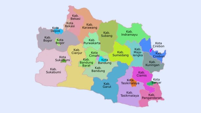
The Geological Survey Centre (PSG) of the Geological Agency under the Ministry of Energy and Mineral Resources has reported a crucial discovery regarding the presence of active fault zones traversing West Java, including areas of vital toll road infrastructure. This finding stems from field monitoring activities by the Active Fault Mapping Survey Team in Majalengka Regency, Sumedang, and Subang to map potential tectonic disaster risks.
Quoting the ministry’s official release, the Head of the Geological Survey Centre, Edy Slameto, along with the Commitment Making Official (PPK) of PSG, conducted direct monitoring of the research team on Thursday (16/10/2025). The activities on that Thursday focused on ensuring the smooth conduct of the survey and directly observing geological conditions related to potential active faults in the area.
Edy explained that this monitoring is crucial to guarantee the accuracy of field mapping data.
“This activity aims to ensure the smooth implementation of the survey, while also monitoring geological conditions in the field related to the potential active faults in the area,” he stated.
The field visit targeted the first location on the Cisumdawu Toll Road at Kilometre 177, Bojongtotor Hamlet, Sirnamulya Village, Sumedang Utara Subdistrict. This site is an area of land movement that occurred at the end of May 2025, with intensive soil subsidence due to weather factors.
Edy elaborated that the soil structure around the toll road has a complexity that requires extra supervision.
“Preliminary observations indicate that soil movement in this area is potentially influenced by lithological conditions and complex geological structures, thus requiring ongoing monitoring for risk mitigation around strategic infrastructure such as toll roads,” he said.
The second location visited is in Girimukti Village, Sumedang Utara Subdistrict, where the team found rock exposures indicating the presence of the active Cileunyi-Tanjung Sari fault zone. The survey team immediately conducted documentation and measurements of fault plane orientations to determine the direction and characteristics of rock deformation occurring there.
The visit on that day then continued to the third location in Cibuluh Village, Ujung Jaya Subdistrict, Sumedang Regency. In this area, rock exposures with broken layers were found, indicating ongoing tectonic activity to this day.
Edy emphasised that the fault zones in the area are still highly active as they are seen to cut through the youngest soil layers.
“The fault section that cuts through to the youngest surface layers indicates that the fault zone in this area is still active and has the potential to cause deformation in the future,” he asserted.
Through this monitoring activity, the Geological Survey Centre reaffirms its commitment to increasing vigilance against potential geological hazards in West Java. Edy hopes these findings can be promptly followed up by local governments in formulating spatial planning policies.
“Data and findings from the field are expected to serve as a basis for geological disaster mitigation planning and support local government efforts in sustainable and disaster-resilient spatial management,” he concluded.