
8 Areas on Tsunami Alert in North Sulawesi
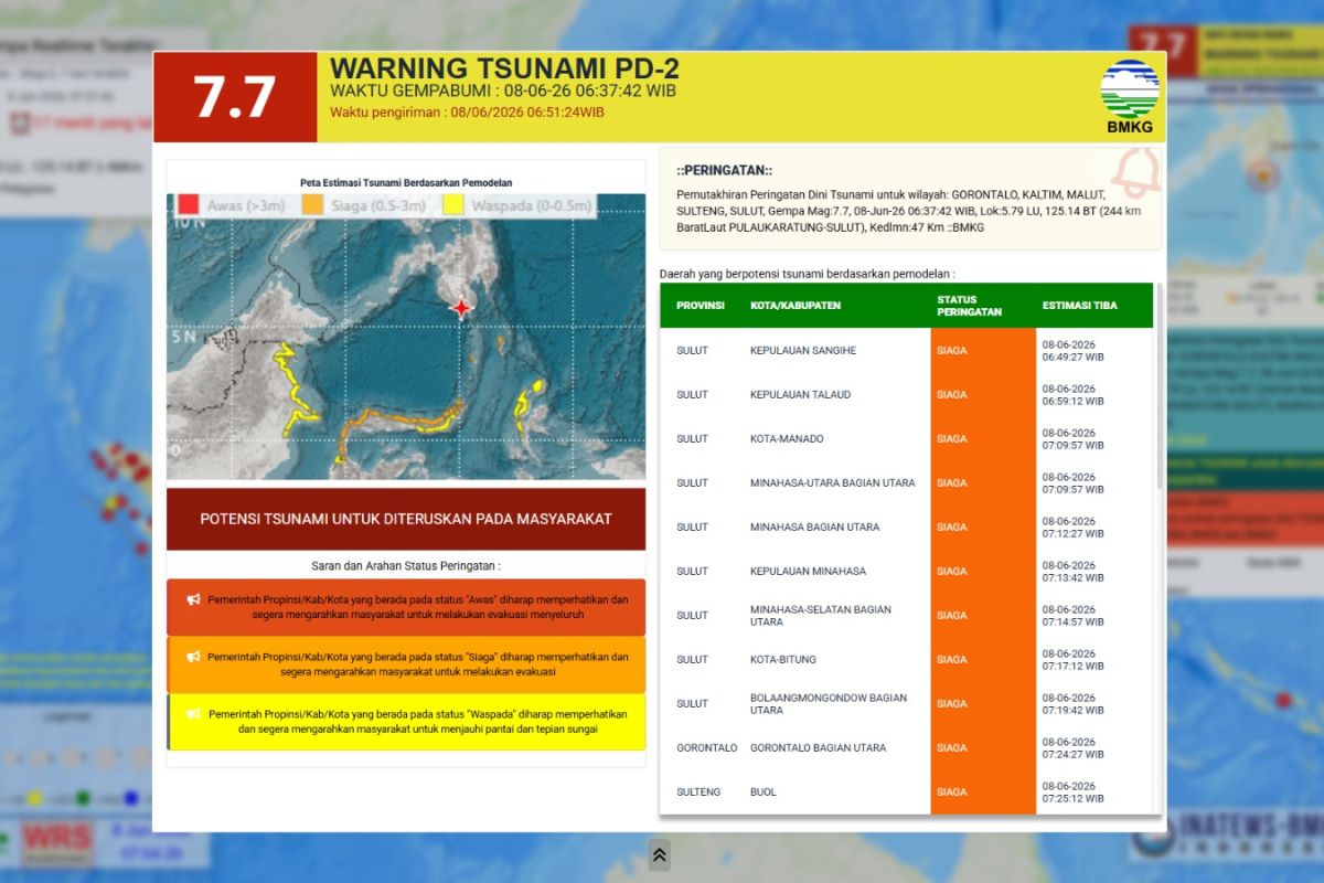
The Meteorology, Climatology, and Geophysics Agency (BMKG) has issued an early tsunami warning following a 7.7 magnitude tectonic earthquake that struck the southern coast of Mindanao, Philippines, on Monday, 8 June 2026, at 06:37 WIB. Based on BMKG’s analysis, the earthquake’s epicentre was located at coordinates 5.80°N and 125.14°E, in the sea approximately 244 kilometres northwest of Karatung Island, North Sulawesi, at a depth of 47 kilometres. The impact of this powerful tremor has triggered ‘Alert’ and ‘Warning’ statuses across several areas in North Sulawesi.
Ricky Daniel Aror, Coordinator of Data and Information at the Bitung Maritime Station, confirmed that several regencies and cities in North Sulawesi are currently within the red zone for tsunami early warnings. BMKG has requested that the public in affected areas remain calm but maintain high levels of vigilance. Ricky Daniel Aror emphasised the importance of following official instructions from local authorities.
“We hope that residents continue to comply with recommendations from the local government, particularly the Regional Disaster Management Agency (BPBD),” Ricky stated when contacted in Manado on Monday.
As of the time of this report, BMKG continues to monitor sea level developments and aftershock seismic activity. Residents in coastal areas categorised under the ‘Alert’ status are advised to immediately move away from the coast and head to higher ground via the evacuation routes established by the local BPBD. BMKG has confirmed that tsunami waves resulting from the 7.7 magnitude earthquake in Mindanao have been detected in three locations in Indonesia, with waves ranging from 9 to 18 cm detected in Ulu Siau, Melonguane, and North Maluku. The National Disaster Management Agency (BNPB) has urged residents in North Sulawesi, Gorontalo, Central Sulawesi, North Maluku, and East Kalimantan to stay away from the coast.