
64 Forest and Land Fire Hotspots Detected in North Sumatra, Most in Karo
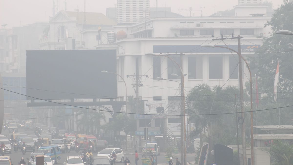
The Meteorology, Climatology, and Geophysics Agency (BBMKG) Region I Medan recorded that the number of hotspots in North Sumatra reached 64 points. These hotspots have the potential to trigger forest and land fires (karhutla).
“On Sunday (23/8), 64 hotspots were detected in North Sumatra,” said BBMKG Region I Medan forecaster Budi Prasetyo to CNNIndonesia on Monday (24/8).
The distribution of these hotspots includes 14 points in Karo Regency, 11 in North Labuhanbatu, 7 in Labuhanbatu, 7 in North Padang Lawas, 6 in Dairi, 6 in Humbang Hasundutan, 5 in Central Tapanuli, 2 in Asahan, 2 in South Tapanuli, 2 in North Tapanuli, 1 in Langkat, and 1 in Pakpak Bharat.
“Meanwhile, on Monday at 15.00 WIB, the number of monitored hotspots decreased to six points, with two points in Labuhanbatu Regency and four points in South Labuhanbatu Regency,” he explained.
According to Budi, the air temperature in Medan City reached 36.1 degrees Celsius on Monday (24/8) between 13.00 and 14.00 WIB.
This condition caused residents of Medan City to experience very scorching weather. The hot temperatures felt by the public are influenced by relatively dry atmospheric conditions, which reduce cloud formation.
“This hot temperature is caused by relatively dry air masses, resulting in less cloud growth, so that maximum sunlight reaches the surface,” said Budi Prasetyo.
BMKG estimates that moderate to heavy rain is likely to occur in several areas, including Langkat Regency, Binjai City, Medan City, Deli Serdang, Serdang Bedagai, Tebing Tinggi, Asahan, Batubara, Labuhanbatu, North Labuhanbatu, South Labuhanbatu, Pakpak Bharat, Dairi, Karo, Humbang Hasundutan, and Simalungun.
“Then Pematangsiantar, Toba, Samosir, South Tapanuli, Padangsidimpuan, Central Tapanuli, Sibolga, North Tapanuli, Padang Lawas, North Padang Lawas, Mandailing Natal, up to the Nias Islands region,” he said.
On the other hand, BMKG also reminded the public to be aware of the potential for strong winds that may still occur locally. This phenomenon generally lasts for a short duration, ranging from five to ten minutes.
“The potential for strong winds still exists, generally localised with a short duration. This occurs due to unstable atmospheric conditions in several areas with a relatively limited coverage,” he explained.
According to Budi, the current weather conditions in North Sumatra are influenced by several atmospheric factors.
These include active atmospheric waves along the east coast of North Sumatra, wind convergence and confluence from the Indian Ocean to the eastern slopes of North Sumatra, and sea surface temperatures that are warmer than normal.
“These conditions increase the supply of water vapour to the atmosphere, thereby supporting the growth of convective clouds that have the potential to produce heavy rain, lightning, and strong winds,” he explained.
In addition, the strengthening of the Australian Monsoon causes clear to cloudy weather in the morning and afternoon. This situation triggers optimal surface heating, or solar heating, creating atmospheric instability that supports the formation of rain clouds from midday to night.
“The weather in North Sumatra over the coming week is generally still dominated by rain with moderate to very heavy intensity,” he said.
BMKG urged the public to remain alert to the potential for extreme weather, especially when engaging in outdoor activities. The public is also asked to always follow official information issued by BMKG and not easily trust weather information from unaccountable sources.
“Regional heads are also urged to continue coordinating with local BPBD, TNI, and Polri so that anticipatory measures can be taken in the event of extreme weather that has the potential to cause hydrometeorological disasters,” concluded Budi.
Source: jawawa.id (https://jawawa.id/newsitem/64-forest-and-land-fire-hotspots-detected-in-north-sumatra-most-in-karo-1787583133)
Originally published by CNN Indonesia (https://www.cnnindonesia.com/nasional/20260824192234-20-1395988/ada-64-hotspot-karhutla-di-sumut-paling-banyak-di-karo), translated from Indonesian