
615 Residents Evacuated as Mount Sinabung Eruption Threat Grows
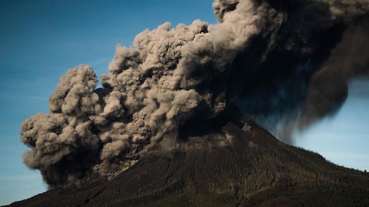
615 Residents Evacuated as Mount Sinabung Eruption Threat Grows
Reporter
September 2, 2026 | 11:50 am
TEMPO.CO, Jakarta - Indonesian authorities have evacuated 615 residents from Kuta Tengah village in North Sumatra’s Karo Regency as volcanic activity at Mount Sinabung intensified following a major eruption earlier this week.
Acting Head of the National Disaster Management Agency’s (BNPB) Data, Information and Disaster Communication Center, Berton SP Panjaitan, said Wednesday that the evacuation was carried out as a precaution against exposure to volcanic hazards.
“Based on preliminary data, around 211 families, or 615 residents of Kuta Tengah Village, have been evacuated to the emergency response post in Sukatepu Village, Naman Teran District,” Berton said in Jakarta.
The evacuation prioritized residents living near areas considered vulnerable to eruptions. In addition to Kuta Tengah, Payung Village in Payung District is also within an area potentially exposed to Mount Sinabung’s volcanic activity, Berton said.
Residents of Payung Village, however, remained at home as of Wednesday while staying on high alert under the supervision of a joint response team.
The BNPB Operations Control Directorate confirmed that the mass evacuation followed an increase in Mount Sinabung’s activity, prompting Indonesia’s Center for Volcanology and Geological Hazard Mitigation (PVMBG) to raise the volcano’s alert status from Level II, or Alert, to Level III, or Standby.
Mount Sinabung had previously sent a thick ash column about 3,500 meters above its summit.
Authorities have since expanded the restricted area around the volcano as a precaution.
The BNPB urged residents and tourists to avoid all relocated villages, areas within a 3-kilometer radius of the summit, and sectors extending up to 6 kilometers southeast of the volcano, in line with recommendations from the Geological Agency under the Energy and Mineral Resources Ministry.
Read: Indonesia’s Mount Tambora Hiking Trails Closed Over Forest Fire Risk
Click here to get the latest news updates from Tempo on Google News