
200,000 Hectares of Indonesian Land and Forest Burned This Year, Worst Since When?
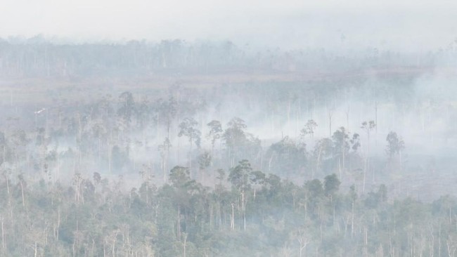
Jakarta, CNBC Indonesia - Forest and land fires (karhutla) have once again struck Indonesia in 2026.
Data from the National Disaster Management Agency (BNPB) recorded 454 forest and land fire incidents across various regions of Indonesia throughout this year.
Meanwhile, data from the Ministry of Forestry’s Forest and Land Fire Monitoring System shows that from January to July 2026, the total burned area reached 202,010.96 hectares.
This figure jumped sharply compared to the end of June, which was still at 107,465.47 hectares. This means that around 94,545.49 hectares burned in July alone, nearly doubling Indonesia’s forest and land fire area in a single month.
Forest and land fire incidents are feared to continue increasing due to the ongoing El Niño. The effects of El Niño are even expected to persist at least until early 2027.
The Meteorology, Climatology, and Geophysics Agency (BMKG) is also still detecting hotspots with high confidence levels, especially in Kalimantan and Papua, during the period of 18-24 August 2026, in line with the dry conditions that still dominate most of Indonesia.
BMKG still describes El Niño as very strong for the period of 21-27 August, with the dry season remaining dominant.
In recent years, the extent of forest and land fires in Indonesia has fluctuated considerably. In terms of area, forest and land fires up to July 2026 are still far below the extreme episodes of 2015, 2019, and 2023. However, this year’s data only covers January to July 2026, so it is likely to continue growing.
This situation means that the development of forest and land fires in the coming months still needs to be closely monitored.
Forest and land fires also do not only occur in areas administratively categorised as forest. Data from the Ministry of Forestry’s SIPONGI shows that of the burned area from January to June 2026, around 54% was in forest areas and 46% was in other use areas (APL) or non-forest areas.
The impact of forest and land fires does not stop at the loss of forest or land cover. The losses can extend to homes and public facilities, health, agriculture and plantations, transport, trade, industry, tourism, and productivity and economic activity.
Specifically from a health perspective, the impact of forest and land fires can reach areas very far from the fire source. The United States Environmental Protection Agency (EPA) notes that fire smoke can travel hundreds or even thousands of miles. Exposure is linked to various effects, ranging from coughing and irritation to worsening respiratory and cardiovascular diseases and the risk of premature death.
The economic impact of forest and land fires was clearly visible in 2015, when around 2.6 million hectares of forest and land burned. This was one of the worst forest and land fire episodes in the past decade.
President Joko Widodo stated that losses from forest and land fires at that time reached around Rp220 trillion. These losses came from flight cancellations, offices being closed, and halted economic activity.
The impact also extended to health. In the same year, around 504,000 people experienced health problems, especially acute respiratory infections (ISPA).
The 2015 experience shows that the magnitude of forest and land fire impacts is not only reflected in the area burned.
With more than 202 thousand hectares of land already burned by July 2026, the dry season still ongoing, and the threat of El Niño expected to persist until early 2027, the risk of losses this year could also threaten Indonesia’s economic activity.
Forest and land fires also occurred on a large scale in various parts of the world throughout 2026.
Based on data from the Global Wildfire Information System (GWIS) compiled by Our World in Data, the total area burned globally has reached around 112.3 million hectares as of 1 August 2026. The largest distribution is concentrated in Africa, while Australia, Asia, and the Americas also recorded burned areas in the millions of hectares.
This data does not entirely represent destructive wildfires because the GWIS coverage can also include agricultural land burning or planned burning.
Nevertheless, the scale of burned area shows that fire risk in 2026 is occurring in various parts of the world. This condition is taking place amid the strengthening El Niño, which is also influencing global temperature and rainfall patterns, although its impact differs in each region.
Source: jawawa.id (https://jawawa.id/newsitem/200-000-hectares-of-indonesian-land-and-forest-burned-this-year-worst-since-when-1787557896)
Originally published by CNBC Indonesia (https://www.cnbcindonesia.com/research/20260824093442-128-761828/200000-lahan-hutan-ri-terbakar-tahun-ini-terburuk-sejak-kapan), translated from Indonesian