ESDM: Rumbling sounds still heard from Mount Karangetang crater
Manado (ANTARA) - The Ministry of Energy and Mineral Resources (ESDM) in its volcanic activity report for the period 1-15 April 2026 states that rumbling sounds are still heard from the crater of Mount Karangetang, Sitaro Islands Regency, North Sulawesi.
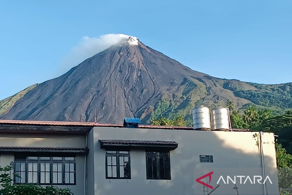
“Visual conditions at the main crater (south) show no observed rockfalls or effusive eruptions, with maximum smoke height reaching 150 metres above the summit, and rumbling sounds occasionally heard at the volcano observatory post,” said Acting Head of the Geological Agency Lana Saria in the report received in Manado on Tuesday.
Conditions at the northern crater (crater two) show moderate to thick white smoke with a maximum height of 400 metres above the summit, fire glow observed in the smoke column up to a maximum of 20 metres, and weak to strong rumbling sounds occasionally heard.
Effusive eruption activity in the form of lava flows towards the south into the Sumpihi River up to 200-1,200 metres, this condition remains within the recommended distance.
Seismicity during the period shows an increase compared to the previous week, with blast earthquakes increasing while intensity remains high.
The characteristics of hot ash clouds from Mount Karangetang’s collapses occur from the accumulation of lava material that collapses or landslides.
In addition, she emphasised the importance of being alert to lava slides from the northern crater towards the southwest-south direction and being wary of lahar events during heavy rain at the summit.
Based on comprehensive analysis and evaluation up to 15 April 2026, the volcanic activity level of Mount Karangetang is at Level II (Alert) with recommendations adjusted to the current hazard potential.
The public, visitors, tourists, and climbers are prohibited from activities and approaching the area within a 1.5 kilometre radius of the main crater (south) and crater two (north), as well as 2.5 kilometres in the southwest and south sectors from the main crater.
Communities around Mount Karangetang are advised to prepare masks to cover the nose and mouth to anticipate respiratory tract hazards if ashfall occurs.
Communities living along riverbanks originating from the summit of Mount Karangetang are urged to increase readiness against the potential threat of rain-induced lahars and flash floods.
Throughout the period, there were 424 blast earthquakes, 15 harmonic tremors, 109 non-harmonic tremors, three hybrid/multiple-phase earthquakes, 15 shallow volcanic earthquakes, 81 deep volcanic earthquakes, three local tectonic earthquakes, 18 felt earthquakes on the I-III MMI scale, and 939 distant tectonic earthquakes recorded.